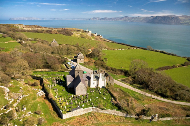
1. The Snowdonia National Park, 2. The Brecon Beacons National Park, 3. Cardiff Castle, 4. Devil's Bridge Falls, 5. Caernarfon Castle, 6. Conwy Castle, 7. Pembrokeshire Coast National Park, 8. Portmeirion, 9. Beddgelert, 10. The National Slate Museum, 11. Bodnant Garden, 12. The Pontcysyllte Aqueduct, 13. Anglesey, 14. Llandudno. Wales is a country within the United Kingdom. It is bounded to the east by England, to the north and west by the Irish Sea, to the southwest by the Celtic Sea, and to the south by the Bristol Channel. Wales has many fantastic reasons to visit, such as stunning castles, magnificent shopping arcades, and several well-preserved historic structures. Here are some most interesting attractions in Wales you couldn't miss. Take a look and plan your upcoming trip to the following beautiful places.
- The Snowdonia National Park
- The Brecon Beacons National Park
- Cardiff Castle
- Devil’s Bridge Falls
- Caernarfon Castle
- Conwy Castle
- Pembrokeshire Coast National Park
- Portmeirion
- Beddgelert
- The National Slate Museum
- Bodnant Garden
- The Pontcysyllte Aqueduct
- Anglesey
- Llandudno
The Snowdonia National Park
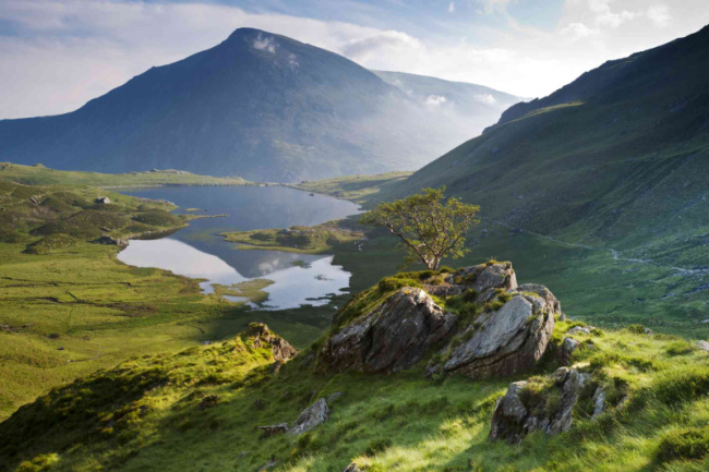
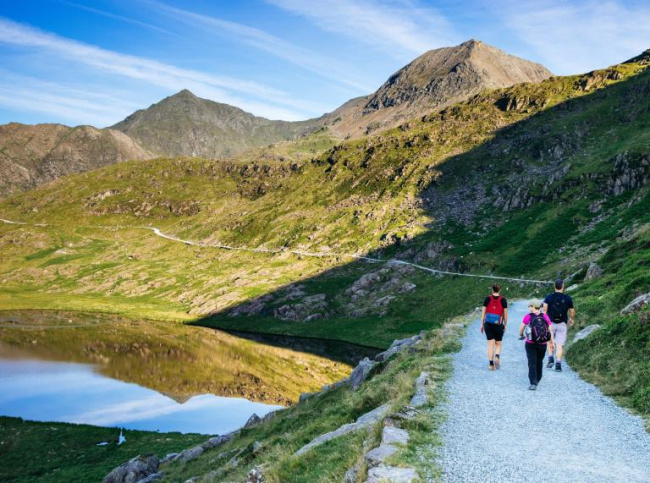
The Snowdonia National Park, also known as Welsh Parc Cenedlaethol Eryri, is an 838-square-mile national park in Gwynedd and Conwy counties in northern Wales (2,171 square km). It is well renowned for its mountains, which are mostly made of volcanic rock and are broken by valleys formed by Ice Age glaciers. With an elevation of 3,560 feet, Snowdon Mountain’s summit, Yr Wyddfa, in the park’s northwest corner, is the highest peak in England and Wales (1,085 meters). The park’s historic Snowdon Mountain Railway rises to the peak of Mount Snowdon, Wales’ tallest mountain, with views across the sea to Ireland. The park also has a large network of paths, over 100 lakes, and jagged peaks such as Cader Idris and Tryfan.
Eryri is Wales’ largest National Park, covering an area of 823 square miles. Eryri’s scenery is steeped in culture, history, and legacy, and the Welsh language is part of the day-to-day fabric of the area. Tourism thrives as a result of the opportunities for climbing, hill walking, fishing, and sightseeing. Tourist centers in and near the park include Bala, with recreational facilities on Bala Lake, the largest natural lake in Wales. Every year, about 4 million visitors visit Eryri to explore its towering peaks and stunning valleys, find tranquillity on less-traveled trails and discover its abundant recreation choices.
Location: In northwestern Wales
tripsavvy.com
visitwales.com
The Brecon Beacons National Park
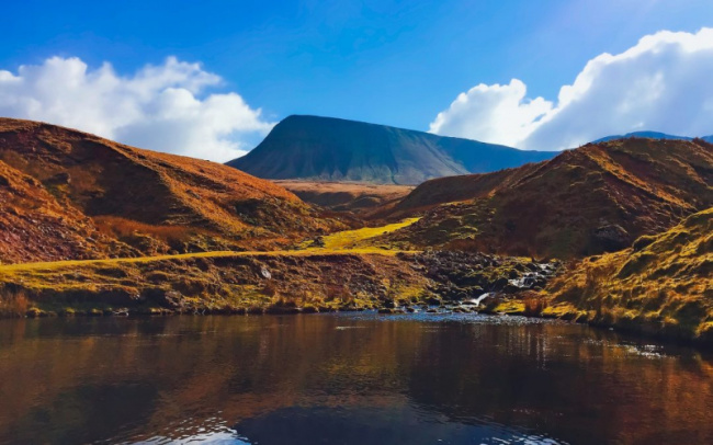
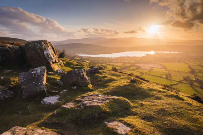
The Brecon Beacons National Park is one of three national parks in Wales, located in southern Wales and centered on the Brecon Beacons range of hills. It contains the Black Mountains (Welsh: Y Mynydd Du or Mynyddoedd Duon) in the west, Fforest Fawr and the Brecon Beacons in the center, and the Black Mountains (Welsh: Y Mynydd Du or Mynyddoedd Duon) in the east.
The Brecon Beacons National Park was formed in 1957, the third and last Welsh national park, following Snowdonia in 1951 and the Pembrokeshire Coast in 1952. It stretches from Llandeilo in the west to Hay-on-Wye in the northeast and Pontypool in the southeast, covering 519 square miles (1,340 km2) and encompassing four main regions – the Black Mountain in the west at Fan Brycheiniog, Fforest Fawr and the Brecon Beacons in the center. The western half was designated a European and global geopark in 2005 as Fforest Fawr. This encompasses the Black Mountain, Fforest Fawr’s ancient extent, and much of the Brecon Beacons and nearby lowlands.
Walking, cycling, mountain biking, and horseback riding are among the outdoor activities available in the park, as are sailing, windsurfing, canoeing and fishing, rock climbing, hang-gliding, caravanning, camping, and caving. The Taff Trail, a long-distance cycling route connecting Brecon and Cardiff, travels through the Beacons, and the first walk across the entire length of the Brecon Beacons National Park began in 2005. The Beacons Way is a 99-mile (159-kilometer) path that begins in Abergavenny and ends in Llangadog, Carmarthenshire, via The Skirrid (Ysgyryd Fawr).
Location: in southern Wales
trekfest.org.uk
breconbeacons.org
Cardiff Castle
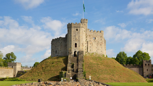
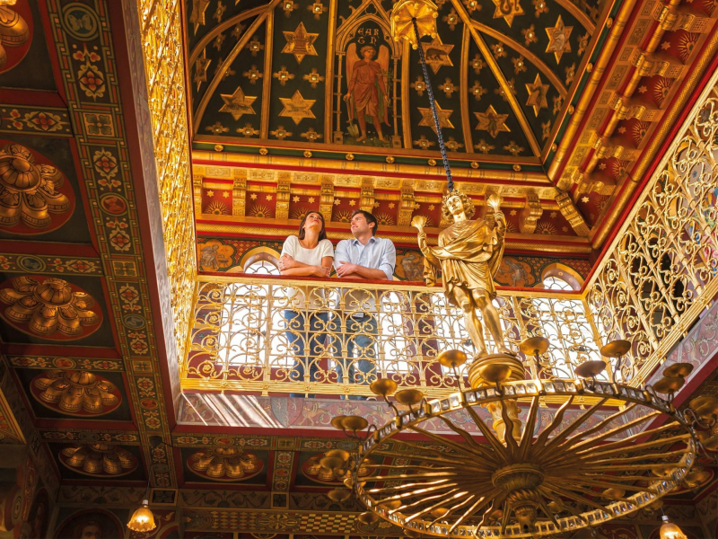
Another interesting attraction In Wales we want to introduce to you is Cardiff Castle. Cardiff Castle, maybe the most photographed of Wales’ many castles, is a must-see. Cardiff Castle is a medieval castle and Victorian Gothic revival palace in Cardiff’s city center. Norman conquerors built the initial motte and bailey fortress in the late 11th century on top of a 3rd-century Roman fort. With elements still standing from more than 1,000 years ago, this magnificently maintained fortress can be explored for several hours. Allow plenty of time in your Cardiff sightseeing plan for this.
The State Apartments are famous for their educational exhibitions about life in the castle throughout the ages, as does the magnificent ancient chapel. The well-preserved Banqueting Hall, with its medieval frescoes and ornate fireplace, is also noteworthy. There are several guided tour options available, as well as an educational audio guide that can be picked up at the tourist center.
If you have time following your castle adventure, attempt to visit the National Museum Cardiff. This huge site, unquestionably at the top of the list of the best free things to do in Cardiff, has outstanding exhibits focused on archeology, zoology, botany, and the arts. The National Museum of Art is also housed in the same structure. This outstanding art gallery house works by some of the world’s most renowned artists, including Old Masters and Welsh painters.
Location: Cardiff, Wales
expedia.com
Devil’s Bridge Falls
The phrase “Devil’s Bridge” refers to a number of historic bridges found largely in Europe. The majority of these bridges are stone or masonry arch bridges, which are noteworthy technological achievements in an ancient buildings. They were an object of intrigue and legends throughout antiquity and medieval Europe due to their distinctive design.
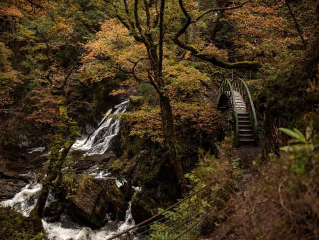
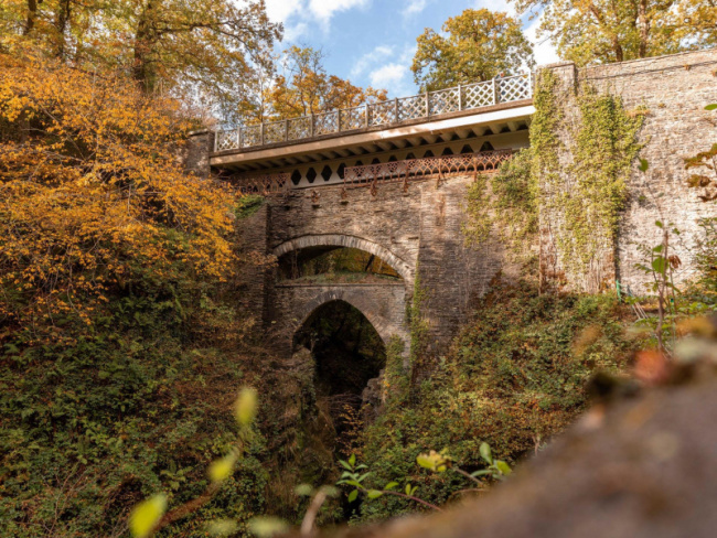
Devil’s Bridge Falls is a stunning waterfall attraction and nature trails in the heart of the Mid Wales Cambrian Mountains, located near Pontarfynach in Ceredigion, mid-Wales, 12 miles from Aberystwyth. It is a must-see natural feature in Wales and a well-known tourist destination in the heart of the Cambrian highlands, with a perilous-looking stone bridge vista of a cascade that plunges into a deep, wooded gorge.
Devil’s Bridge Falls have drawn tourists since the 18th century, including William Wordsworth, who described the “Torrent at the Devil’s Bridge” in his poem. Today, you may see the falls from two separate paths. A natural route with waterfalls and three bridges is available. This is a challenging 45-minute hike with 675 steep uneven natural stone steps.Families with younger children would be best served to do the Punchbowl trail. This includes the three bridges and has recently been expanded with a new seating area with views of the three bridges. With 220 slate steps, this is a moderate hike. The steps descend to a vantage point from which you can observe the ocean pounding on the worn-out rock. This is also where you can get a nice view of the three bridges, which are built one on top of the other.
Location: Woodlands, Pontarfynach, Aberystwyth, Wale
Caernarfon Castle
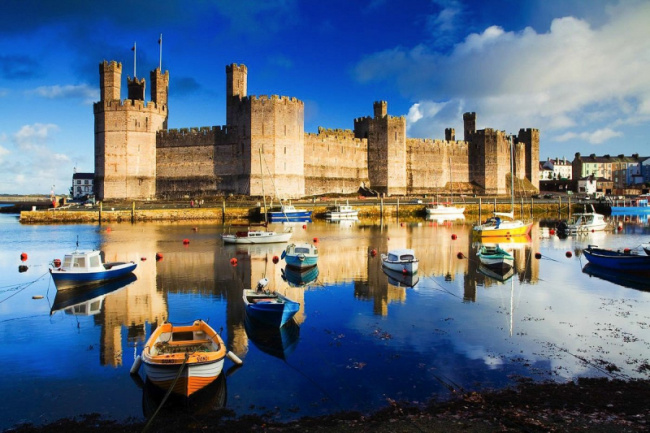
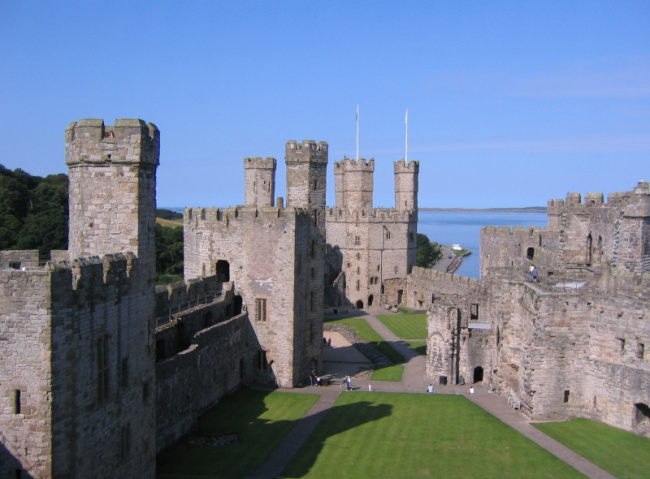
Caernarfon Castle is a medieval fortification in Caernarfon, Gwynedd, north-west Wales. From the late 11th century until 1283, when King Edward I of England began to replace it with the current stone structure, it was a motte-and-bailey fortress. Because the Edwardian town and castle served as the administrative capital of north Wales, the defenses were built on a great scale.
Caernarfon Castle arose from a violent struggle with Welsh princes. Of course, its massive curtain walls and intimidating King’s Gate were built to withstand the assault. Several polygonal turrets are dotted along the curtain wall, from which flanking fire might be launched. There were battlements on the roofs of the walls and towers, and shooting galleries ran along the southern face; galleries ran along the northern face were planned but never built. According to military historian Allen Brown, these factors conspired to create Caernarfon Castle one of the most fearsome concentrations of artillery in the Middle Ages.
The majority of the northern towers were four floors tall, including a basement. The Eagle Tower at the castle’s western corner was the most impressive. It contains three turrets that were previously topped by eagle statues. The tower had luxurious chambers and was most likely built for Sir Otton de Grandson, Wales’ first justiciar. A water gate on the basement level let visitors traveling up the River Seiont enter the castle.
Location: Caernarfon, Gwynedd, north-west Wales
tripadvisor.co.uk
en.wikipedia.org
Conwy Castle
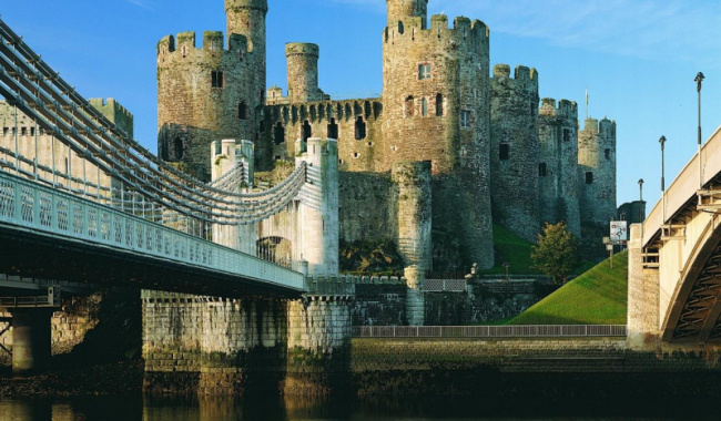
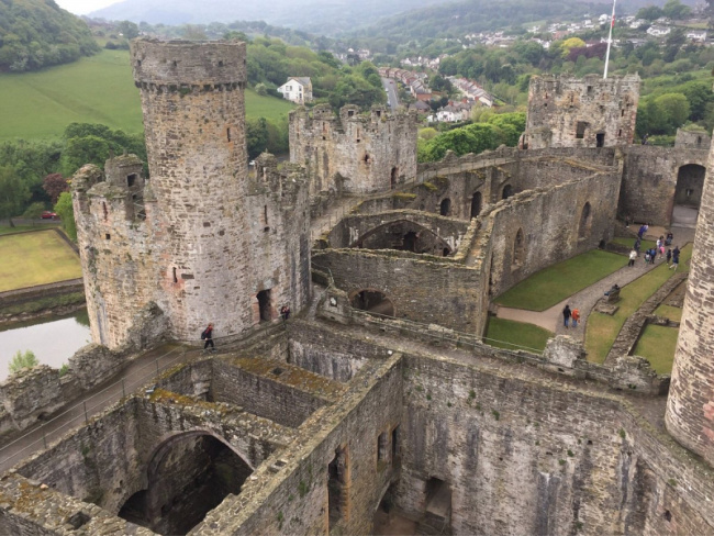
Conwy Castle is a fortified structure in Conwy, North Wales. Edward I erected it between 1283 and 1287 during his conquest of Wales. Constructed as part of a larger project to build the walled town of Conwy, the total defenses cost roughly £15,000, which was a large sum at the time. Several wars were fought in the castle during the next few centuries. It withstood Madog ap Llywelyn’s siege in 1294-95, served as a brief sanctuary for Richard II in 1399, and was held for several months by soldiers loyal to Owain Glyndwr in 1401.
Following the commencement of the English Civil War in 1642, forces loyal to Charles I defended the fortress until 1646 when it surrendered to Parliamentary Forces. In the aftermath, Parliament partially slighted the castle to prevent it from being used in another insurrection, and it was finally entirely demolished in 1665 when its last iron and lead were scraped and sold. In the late 18th and early 19th centuries, Conwy Castle became a popular location for painters. Visitors increased, and early repair work was completed in the second half of the nineteenth century. Cadw manages the destroyed castle as a tourist attraction in the twenty-first century.
Conwy is designated by UNESCO as one of the best examples of late 13th-century and early 14th-century military architecture in Europe, and it is a World Heritage Site. The rectangular castle is made of local and imported stone and sits on a coastal ridge overlooking an important crossing point across the River Conwy. It is divided into two wards and is fortified with eight huge towers and two barbicans, as well as a postern entrance that leads down to the river, allowing the castle to be resupplied from the sea. It has the oldest remaining stone carvings in Britain.
Location: Conwy, in North Wales
visitconwy.org.uk
Pembrokeshire Coast National Park
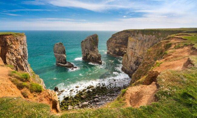
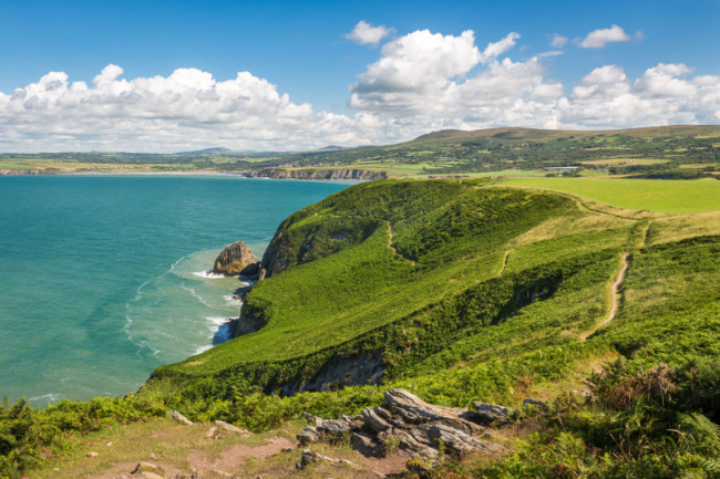
Pembrokeshire Coast National Park is a national park in west Wales that runs along the Pembrokeshire coast. It was designated a National Park in 1952. The Brecon Beacons and Snowdonia National Parks are the other two national parks in Wales. It is the only national park in the United Kingdom that is primarily made up of coastal landscapes.
The topography of the National Park is diverse, including steep cliffs, sandy beaches, wooded estuaries, wild inland hills, the Preseli Hills’ moorland, and the wooded Gwaun valley. 629 km2 is the total area (243 sq mi). The south Pembrokeshire coast, including Caldey Island, the Daugleddau estuary, the St Bride’s Bay shoreline, including the coastal islands, and the Preseli Hills are all distinct sections.
Wales has more than its fair share of stunning coastline, being surrounded by sea on three sides. Some of the most impressive may be found along the coast of the Pembrokeshire Peninsula, which juts out into the Irish Sea, with a large portion of it coming within the confines of the Pembrokeshire Coast National Park (Parc Cenedlaethol Arfordir Penfro).
Tourists can best explore this magnificent scenery on foot along the dramatic Pembrokeshire Coast National Trail, which is part of the 870-mile (1,400 km) Wales Coast Path, which was officially opened in 2012 and passing through villages such as the picturesque little resort of Tenby, which is still partially enclosed by its medieval walls.
Location: in west Wales
www.nationalparks.uk
pembrokeshirecoast.wales
Portmeirion
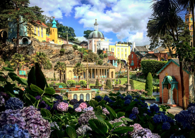
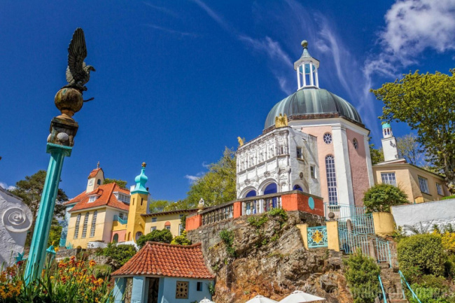
Portmeirion is a tourist village in North Wales’ Gwynedd. Sir Clough Williams-Ellis conceived and erected it in the manner of an Italian village between 1925 and 1975, and it is now owned by a charitable trust. The village lies in the Penrhyndeudraeth community, on the estuary of the River Dwyryd, 2 miles (3.2 km) southeast of Porthmadog, and 1 mile (1.6 km) from Minffordd railway station. Portmeirion has appeared in various films and television shows, most notably “The Village” in the 1960s television series The Prisoner.
Between 1925 and 1975, Williams-Ellis developed and built the village. He used remnants of demolished structures, as well as works by a number of other architects. Portmeirion’s architectural bricolage and purposefully fantastical nostalgia have been cited as influences on the late-twentieth-century development of postmodernism in architecture.
Writers and television producers have drawn inspiration from Portmeirion. While vacationing in the Fountain 2 suite at Portmeirion, Noel Coward composed Blithe Spirit. Early guests included George Bernard Shaw and H. G. Wells. In 1956, the architect Frank Lloyd Wright visited, as did Gregory Peck and Ingrid Bergman. Stanley Long, a former RAF photographer, came to establish a valuable stereoview series through VistaScreen in the late 1950s. The village also has several ties to the Beatles.
Portmeirion is presently held by a charitable trust and has always operated as a hotel, with the majority of the buildings serving as hotel rooms or self-catering cottages, as well as shops, a cafe, a tea room, and a restaurant. Portmeirion is now a prominent tourist attraction in North Wale, and day trips are available for a fee.
Location: Gwynedd, North Wales
boutiquetours.wales
tripadvisor.com
Beddgelert
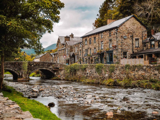
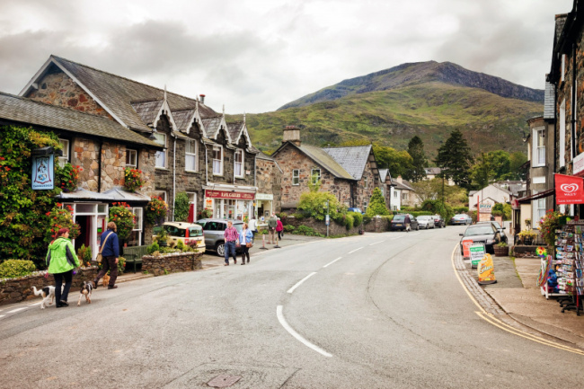
Beddgelert is a village and settlement in Gwynedd’s Snowdonia region, Wales. The population of the settlement, which comprises Nantmor and Nant Gwynant, was 455 according to the 2011 census. It is said to have been named after the mythical hound Gelert. The 86-square-kilometer village is big and sparsely populated.
The village is located in a valley at the junction of the rivers Glaslyn and Colwyn. A historic stone bridge with two arches stands just above the confluence of the rivers in the village’s center. The River Gwynant runs through the area, joining the River Colwyn at what is known as ‘Pont Bren,’ becoming the River Glaslyn. Many of the houses and hotels are made of black stone found in the area. Moel Hebog and its neighbors to the north, as well as a chain of hills rising to the summit of Snowdon, are visible to the west. The village is located on the A4085, which connects Caernarfon (13 miles north) and Porthmadog (8 miles south).
Beddgelert is a popular tourist destination, with its scenic bridge across the River Colwyn immediately upstream of its confluence with the Glaslyn. It is also the closest settlement to the picturesque Glaslyn gorge, a violent river that runs between steep wooded hills. Beddgelert features a variety of hotels, guesthouses, cafes, and restaurants. The village car park is the most convenient access point for ascending Moel Hebog, the mountain that directly overlooks the village. The settlement is traversed by a section of the rebuilt Welsh Highland Railway. The railway station reopened to the public in April 2009. The line connects Caernarfon to the north and Porthmadog to the south.
Location: Gwynedd, Wales
thirdeyetraveller.com
countryfile.com
The National Slate Museum
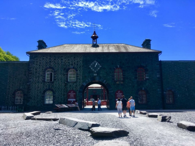
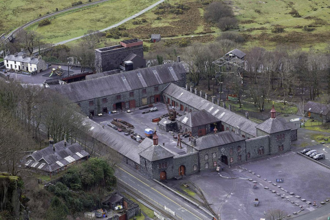
The National Slate Museum (originally known as the Welsh Slate Museum and the North Wales Quarrying Museum) is located in the Padarn Country Park, Llanberis, Gwynedd, in Gilfach Ddu, the 19th-century workshops of the now-defunct Dinorwic quarry. The museum is committed to preserving and displaying relics from Wales’ slate industry. The workshops that supported the quarry and its locomotives were built in 1870 on land generated by the continual tipping of debris from the adjacent Vivian Quarry and were built to replace the store sheds that had previously been located there. Rails entered the main yard through the main entrance as well.
The Llanberis Lake Railway, which uses part of the museum as its workshops, currently connects the museum to the nearby village of Llanberis. After winning a £1.6 million grant from the Heritage Lottery Fund, the museum reopened with displays of Victorian-era slate workers’ cottages that originally stood in Tanygrisiau, near Blaenau Ffestiniog. They were dismantled stone by stone and rebuilt on the site. To Steal a Mountain, a multimedia exhibit at the museum, depicts the lives and activities of the men who quarried slate here.
The museum also has the largest working waterwheel on mainland Britain, which may be viewed from many pathways. The waterwheel was built in 1870 by De Winton of Caernarfon and measures 50 feet 5 inches (15.37 meters) in diameter, 5 feet 3 inches (1.60 meters) in width, and is built around a 12-inch (305 mm) axle. The partly restored Vivian incline, a gravity balance incline where filled slate trains drive empty wagons back up, is close to the museum.
Location: Gilfach Ddu, Wales
museum.wales
Bodnant Garden
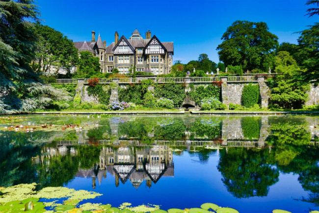
Bodnant Garden, one of the most interesting attractions in Wales, is a National Trust property located near Tal-y-Cafn in Conwy, Wales, with views of the Conwy Valley and the Carneddau mountains.
Bodnant Garden was entrusted to the National Trust in 1949 after being founded in 1874 and developed by five generations of one family. The park encompasses 80 acres of hillside and features formal Italianate terraces, informal shrub borders stocked with plants from all over the world, The Dell, a gorge garden, woodland garden regions with a number of famous trees, and a waterfall. The Winter Garden, Old Park Meadow, Yew Dell, and The Far End, a riverbank garden, have all opened since 2012. Furnace Wood and Meadow first opened its doors in 2017. More new locations, such as Heather Hill and Cae Poeth Meadow, are in the works.
In 2019, over 260,000 visitors visited Bodnant Garden, which is notable for its Laburnum arch, the longest in the UK, which blooms in May and June. Bodnant Garden has an illustrious history with 19th and early 20th century explorers who brought back plants that the garden is now famed for, including four National Collections of Rhododendron forrestii, Magnolia, Eucryphia, and Embothrium species. The garden now boasts twenty-two Champion Trees, which are notable for their age, height, and horticultural merit.
Location: Conwy, Wales
dailypost.co.uk
The Pontcysyllte Aqueduct
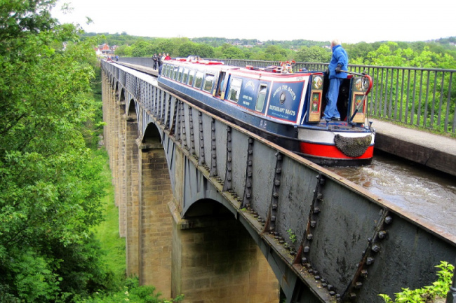
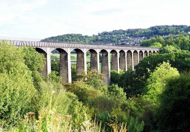
The Pontcysyllte Aqueduct is a navigable aqueduct in northeast Wales that carries the Llangollen Canal across the River Dee in the Vale of Llangollen. As one of the most interesting attractions in Wales, the structure is a Grade I listed structure and a UNESCO World Heritage Site.
The 18-arched stone and cast iron edifice were finished in 1805 after a ten-year planning and construction period. The Pontcysyllte Aqueduct is the longest aqueduct in the United Kingdom and the highest canal aqueduct in the world, measuring 12 feet (3.7 meters) wide. On one side, a footpath goes alongside the river.
The Pontcysyllte Aqueduct was to be a crucial component of the proposed Ellesmere Canal, an industrial waterway that would have established a commercial link between the River Severn at Shrewsbury and the Port of Liverpool on the River Mersey. Although a less expensive construction route to the east was investigated, the westerly high-ground route over the Vale of Llangollen was favored because it would have transported the canal through the mineral-rich coalfields of North East Wales. Because the expected revenues to complete the entire project were never generated, only parts of the canal route were completed. After the Pontcysyllte Aqueduct was completed in 1805, most major activities halted.
Location: Froncysyllte, Wrexham, Wales
nation.cymru
Anglesey
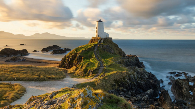
Anglesey, one of the most interesting attractions in Wales, is a Welsh island off the northwest coast. It is part of the Isle of Anglesey, which also comprises Holy Island across the short Cymyran Strait and a few islets and skerries. Anglesey island is the largest in Wales, the seventh largest in the United Kingdom, the largest in the Irish Sea, and the second most populous after the Isle of Man.
The Menai Suspension Bridge, constructed by Thomas Telford in 1826, and the Britannia Bridge, erected in 1850 and replaced in 1980, span the Menai Strait to the mainland. The largest town on Holy Island is Holyhead, which has a ferry service with Ireland that transports over two million passengers every year. Llangefni, the county council seat, is the next largest. Anglesey was a part of Gwynedd from 1974 to 1996.
Along with its sandy beaches and sights like the South Stack Lighthouse, the island’s warm climate attracts both day visitors and campers. Holy Island, which is connected to Anglesey by a bridge, is a popular holiday destination with two promenades (one of them 1.5 miles long). Salt Island is a small island with spectacular views and opportunities for bird viewing. Finally, one of the world’s most renowned photo ops is on the railway platforms of the town with the world’s longest place name (Llanfairpwllgwyngyllgogerychwyrndrobwllllandysiliogogogoch).
nationalgeographic.co.uk
Llandudno
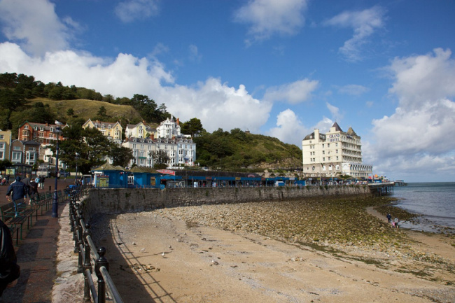
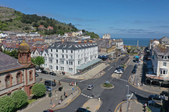
Llandudno is a coastal resort, town, and community in Conwy County Borough, Wales, on the Creuddyn peninsula, which juts out into the Irish Sea. Llandudno is Wales’ greatest coastal resort and was dubbed “the Queen of the Welsh Watering Places” as early as 186, a phrase later used in conjunction with Tenby and Aberystwyth; the word “resort” came later. Llandudno was once in the Gwynedd region of Aberconwy before becoming a part of Caernarfonshire.
The town’s distinct promenade is devoid of the typical beach stores and cafés, which were cleverly positioned behind the seafront to provide Victorian tourists with a quiet experience. The Great Orme, which is easily accessed by a vintage tramway, provides the greatest views of the town and its surroundings. Llandudno, which is well connected by rail and road, is an excellent base for exploring Wales’ magnificent North Coast.
North Shore Beach is one of the best beaches in Llandudno for summer activities like sunbathing, windsurfing, and parasailing. The sheltering beach, also known as Llandudno Beach, includes a lovely Victorian-style pier and a promenade that runs from the foot of Great Orme to Little Orme. The eastern end of the promenade is popular with families since it features a playground, a paddling pool, restaurants, cafes, and concession shops.
en.wikivoyage.org
search.savills.com

