1. Salt Lake, 2. Tunis Lake, 3. Gafsa Lake, 4. Ichkeul Lake. Tunisia is renowned for its golden beaches, warm climate, and distinctive fusion of Arab and Berber traditions. Nationally, regionally, and locally, Tunisians enjoy celebrating hundreds of international film, theater, and music festivals. Additionally, this nation is well-known for its ceramics, ironwork, mosaics, and exquisite lakes. And here are the best lakes to visit in Tunisia.
Salt Lake
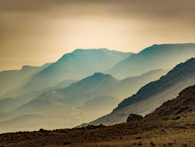
The Chott Djerid salt lake is situated at the transition between the Saharan platform and the Tunisian mountain ranges in a synclinal hollow. With an area of over 5,000 km2, Chott El Jerid (the salt lake) is Tunisia’s largest saline plain. It is the Maghreb’s largest sebkha. Currently, it is between 15 and 20 meters above sea level. Explore the largest salt lake in Africa, which is surrounded by the Saharan Atlas mountain range, and behold the spectacular salt plain that stretches as far as the eye can see. Enjoy this visual phenomenon that identifies the salt depression as you gaze over this salty landscape with its mirages above the horizon.
It’s impossible to avoid stopping as you pass the main road, which connects the southern rim to the point north-west, to take in the little lakes and salt deposits that are a rainbow of colors even on the driest summer days. Unexpectedly, the hue of the saline water changes from light green to soft pink to vivid orange. You will arrive at a site with numerous date palm oases at the lake’s end. Chott el Djerid lies close to Douz, which is known as the “portal to the Sahara.” The salt lake has served as a backdrop for numerous films due to its stunning natural beauty.
There is an almost uncanny silence in the Chott region; barely a blade of grass grows on the saline plain, and not a bird soars over the mostly dry lake. Although industrial salt mining is done on the Chott-El-Djerid today, the locals who live near the salt lakes have always gotten their salt needs met there. On the periphery of nature is a peculiarity. Gypsum that has been dissolved forms oddly shaped, up to one meter tall sand roses when it crystallizes. Selling boosts people’s income a little. On the white, sparkling surface of the Chott, one can frequently see deceiving Fata Morganas that resemble neighboring palm oasis ringed by glistening lakes.
Location: Sahara desert
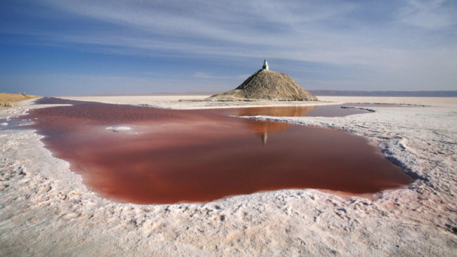
Photo: Rove.me
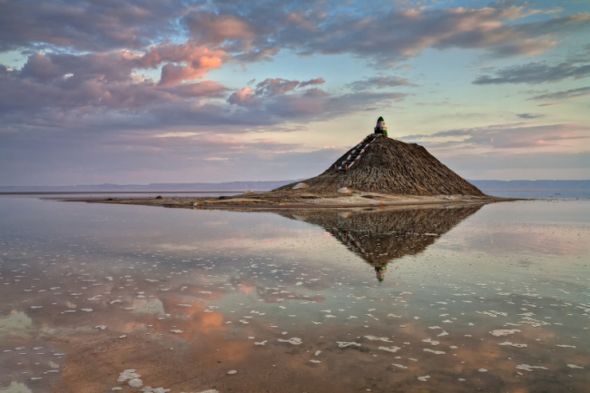
Photo: Carthage Magazine
Tunis Lake
Tunis Lake is the following name in the list of best lakes to visit in Tunisia. The Lake of Tunis is a natural lagoon located between the Tunisian capital city of Tunis and the Gulf of Tunis. The lake is 37 square kilometers in size, but despite this, it has a fairly shallow depth. It once served as Tunis’s natural harbor. More than 100 different bird species can be found wintering in the lake, as well as egrets and yellow-legged gulls that build their nests there. Up to 500 tonnes of fish per year are produced by commercial fisheries in the lake. Since the turn of the 20th century, the lake has suffered significantly from modern urban growth. Both Ramsar sites and IUCN category IV natural reserves are located there. It is protected by the Forestry Code as a wetland of national importance (type VIII) and has been a natural reserve since 1993.
When the lake was still connected to the sea in the second century BC, it was the location of a Carthaginian port, the vestiges of which may still be seen today. The Aghlabids initially erected Chikly Fort on the island of Chikly between 800 and 900 AD, but it was eventually abandoned. At the site, archaeologists have also uncovered mosaics, ceramics, and coins from the Roman and Byzantine eras. The Medina of Tunis, a UNESCO World Heritage Site encircled by the contemporary city of Tunis, sits nearby the lakes, adding to their cultural appeal.
The location has been degraded over the 20th century by littering, eutrophication, residential wastewater, industrial runoff, inadequate drainage, population growth, and urban development. Additionally, traditional fishing and hunting have been abandoned, and there is little existing documentation. The water circulation greatly improved in the second part of the 20th century as a result of large-scale residential urbanization projects that included cleanup efforts. But at the same time, the city grew, the lakeshores were reclaimed, and cultural and ecological treasures were under threat. The vastly improved water quality and the gradual restoration of the lake’s natural functions, however, are the outcomes of the extensive sanitation programs that have been implemented.
Location: Between Tunis and the Gulf of Tunis
Photo: MedWet Culture
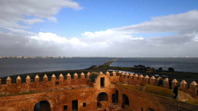
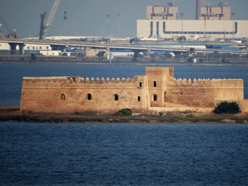
Photo: Pinterest
Gafsa Lake
The Lac de Gafsa, commonly known as the “Mysterious Lake,” unexpectedly surfaced in 2014 next to Om Laryes Road, 25 kilometers from the Tunisian town of Gafsa. Uncertainty surrounds the lake’s genesis or origin. The most likely cause is that a little earthquake broke the rock above the water table, causing millions of cubic meters of water to rise to the surface. Since desert shepherds first came across the lake, Lake de Gafsa has gained both local and worldwide attention as a tourist destination. Since the lake was discovered, hundreds have traveled there merely to see it, dive off the scenic cliffs and swim or scuba dive in it. The development and presence of the Lake de Gafsa are referred to as a miracle or a curse by Tunisians who live in the dry desert region of that lake.
The origin of the lake is still the subject of numerous rumors. The most likely explanation, though, is that a little earthquake split a rock above groundwater, causing millions of cubic meters of water to rise to the surface. The lake now has a one-hectare surface area and a maximum depth of 18 meters. However, phosphate pollution makes bathing in Lac de Gafsa potentially dangerous. Phosphate, an extremely hazardous substance that permeates rocks and soils and is abundant in the Tunisian region, is a fact. The water in a contaminated lake is likely radioactive and cancer-causing. A strange reservoir appeared, and a few days later, algae blooms caused a dramatic change in the reservoir’s color.
Location: Gafsa town
Photo: TheTravelShots

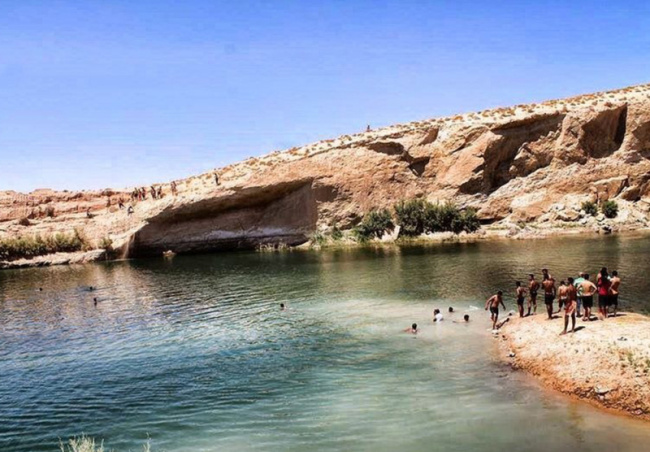
Photo: MyBestPlace
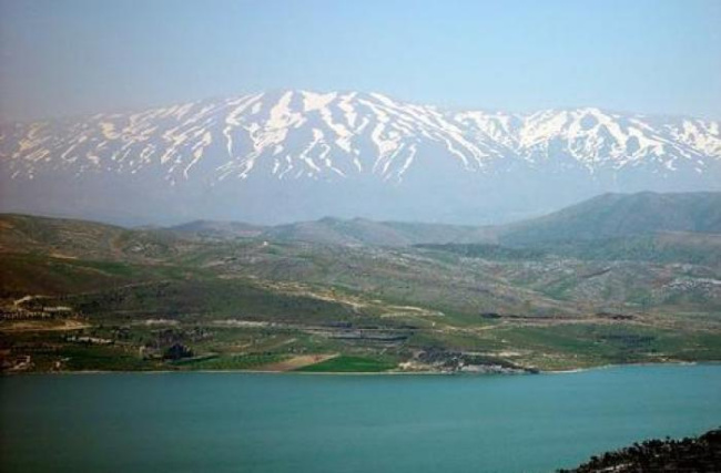
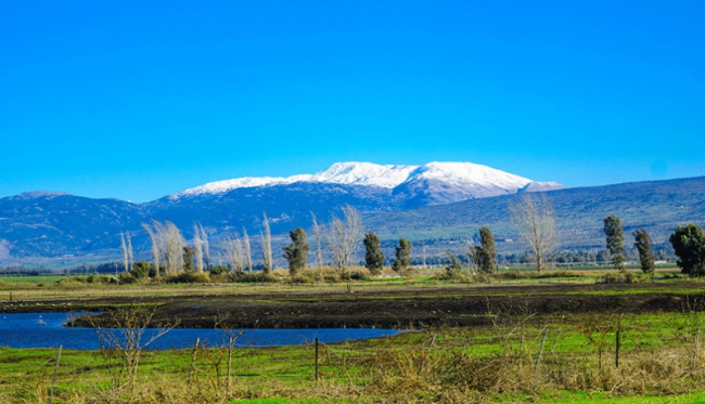
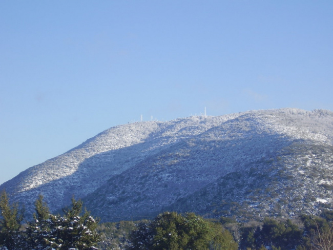
Ichkeul Lake
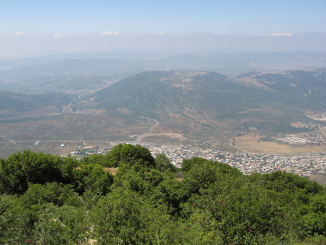
Talking about the best lakes to visit in Tunisia, lake Ichkeul is not to be missed. Lake Ichkeul is a lake in northern Tunisia, located 20 kilometers (12 miles) from Bizerte, the northernmost city in Africa on the Mediterranean Sea. This lake, which has a surface area of 126 square kilometers (49 square miles) and is on the UNESCO World Heritage List, is a striking location of natural beauty that is uncommon in the North African nations. The hydrological system of Lake Ichkeul is exceptional. Its habitat depends on seasonal changes in freshwater flow from five rivers and seawater passing via the Tindja canal, as well as changes in salinity and water level. From October through March, freshwater levels rise, which lowers the lake’s salt levels. Seawater enters the lake during the summer as freshwater evaporates. The freshwater input has been significantly decreased as a result of the construction of the dams, allowing salt-loving plants to take the place of reedbeds, sedges, and other freshwater plant species. The number of migrating birds visiting the lake has significantly decreased as a result of these changes, yet the lake still serves a significant purpose for them.
The Ichkeul National park, which was founded in 1980, is 126 square kilometers in size and has three distinct ecosystems: a mountain with a height of 511 meters, its plains, and an 850 square kilometers-long lake. This is the must-see destination in lake Ichkeul. Visitors entering the park are greeted by lush meadows and a nice view of the lake. Since the park serves as a significant resting place for numerous migratory bird species, one can reflect on the diversity of the landscape filled with different bird species. The lake and marshlands are home to 40–60 different species of birds. The greatest time to visit the park, as is typically the case with other sites, is in the spring because there are more than 500 different varieties of plant life that have been identified there. When the olive trees are in bloom and the cyclamen, iris, and lilac are in abundance, many tourists visiting Tunisia enjoy the pleasure of a quick visit to this stunning natural lake. Along with the abundant vegetation, there is also a diverse wildlife, with migrating birds, otters, buffaloes, porcupines, and mongooses among the most prevalent.
Location: Northern Tunisia
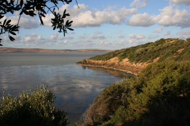
Photo: MedWet
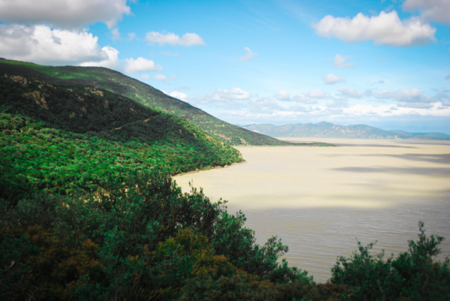
Photo: Wikimedia Commons
Source: https://top-list.co/top-best-lakes-to-visit-in-tunisia-v1287.html